Photo Blog Week 71 - Wed 17 June 2015
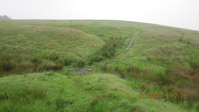
More like VERY Wet Wednesday; one of those days that no matter how zipped up your waterproofs are you are still soaked to underwear at the end of the day. It was not helped by being quite temperate so getting very hot inside the clothes. Boots still drying out two days later.In such miserable weather I carried only an old pocket camera which is already water damaged. The best I could manage was quickly slipping it out of a wet pocket to point in front of me so my photo set this week is basically my view as I plodded through the rain. The camera temporarily announced that it had had enough after reaching the highest point in the park, ironically, just as the rain began to abate.
To keep myself going in the adverse conditions I decided to roughly follow a 6 mile route I had planned some time ago to take in different aspects of the Park. I did give up just before the last bit as I was passing too close to the car and was losing my determination to continue.
Thanks to the three readers who responded to my quick survey. Anyone else, it's still open here:
I'd love it if you would give me a few minutes anonymous feedback Reader Survey (9 questions)
route: Car Park; Estate Office in Lyme Hall; Timber Yard; Bridge over Stream outlet from Mill Pond; Timber Yard Cafe
A fairly quiet car park
The steps up to the House.
It seems that no matter how fit you are feeling, you will be breathing heavily by the top of them.
Inner courtyard of the House
I joined Ranger Jack and Matt to clear two dams that had formed with trapped wood in the stream by the Timber Yard.
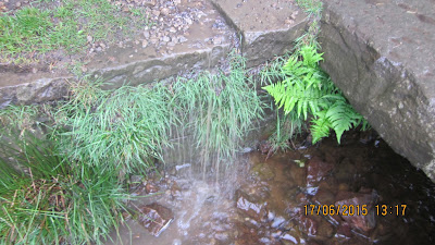
Higher dam; the second obscured by ferns lower down
The took a lot of clearing as the wood and plant fibres had knitted tightly. Three of us worked on them for about 45 mins
After clearing the dams it was back to the Timber Yard for a good hand and arm wash followed by an excellent Venison Chili for lunch
route: Timber Yard; Mill Pond; path behind Turtle Brew; Four Winds Wall; cross country to; The Knott Car Park
rain spotting on the pond
footbridge over the stream
path branching up through the trees toward Turtle Brew
Nice group of trees by the Equestrian field with The Knott behind
Foxgloves
All Weather Wallers on Four Winds
The top half of this view would normally be across Stockport to Manchester and Winter Hill behind
small track from Four Winds crossing to The Knott
Alderley Edge, Manchester Airport, The Cheshire Plain and Welsh Hills beyond? Not today!
Eerily, skylarks were flitting about and calling as I crossed over the Knott
The Knott car park having a quiet day.
Rain Drops on the Soft Rush near the car park
route: The Knott Car Park; West Park Drive; Deer Clough path branch point
West Park drive looking green and wet
side path parallel to the drive through the conifers
The Bracken has grown to height amazingly quickly
back onto the drive
Rhododendron blossom on the hillside above the drive - invasive but pretty
(water and dirt on lens)
bright orange algae on trees along the drive
Deer Clough junction.
Three paths branch off here.
- The far track goes into the old quarry in the Clough after which it climbs along an awkward steep slippery valley side before heading out to Cluse Hey bottom.
- The track up the tree routes heads along a higher side of Deer Clough
- The path to left backtracks but rises gently to the bottom of Pursefield from where you can go up to Paddock Cottage or swing round an easier safer passage along the top of Deer Clough
Path rising gently.
The flattened material to right along the young Bracken is the remains of the bluebells
Leaving the woods below Paddock Cottage
I think that's condensation on the lens - wasn't that misty there
Lovely spot where a young gnarled oak looks out from a rock outcrop over Cluse Hey
route: Rock Outcrop (over Cluse Hey); Ridge to Paddock Cottage; Pursefield Wood ridge (part way); Drinkwater Meadow (Darcy's Pond)
ridge atop Pursefield - Paddock Cottage at summit at far end but can't see through rain
Normally one of the widest views in the Park across Cheshire from Paddock ridge
Paddock Cottage
Pursefield Wood
Gate from Pursfield to Drinkwater Meadow
Darcy's Pond
fancy a dip anyone - you wouldn't be any wetter!
route: Drinkwater Meadow (Darcy's Pond); exit at corner near Paddock; Cluse Hey top path; Knightslow Wood; Bowstones track; Bowstonegate Farm entrance
wall path above Cluse Hey - last year's brown bracken amongst this year's fresh greens
ladder stile into Knightslow Wood
water pouring off sides into stream
peering out to the Moor through the trees
even in this light the vivid green of young beech leaves shine out
mist among the trees inside the wood
exit to the Moor
looking down Knightslow Wood track toward Lime Avenue
mist sitting above as I head up Bowstones track
Highland Cattle chilling on the High Land
mist
more mist
final part of the ascent nearing Bowstonegate Farm
Park Entrance near Bow Stones
route: Bowstonegate Farm entrance; Moor top path; High View Point
aerials at the farm peeing through the mist and rain
"View Point" plinth at highest point in the Park
It was about now that the camera was complaining. I had tried to wipe the lens so many times I no longer had anything dry to do so and there seemed no point in continuing to collect damp pictures.
route: High View Point; steep descent by quarry; Lantern Wood (middle path); Cater's Slack; far stile to East Lodge track; around copse then via Coalpit Wood dip to; The Cage; drop to Hawthorn Drive; (at this point in my plan was to drop to Crow Wood and circle it before returning to Timber Yard but I abandoned this section. ) return via Hawthorn Drive (END)
As I leave the Moor and enter Lantern Wood, the weather is breaking over Manchester in the distance
Car Park?
Feedback Reminder:
I'd love it if you would give me a few minutes anonymous feedback Reader Survey (9 questions)Today's track and profile
Total: 7.4 miles (11.85 km) 4 hr 30 min
This Time Last Year
Have a look at This Time Last Year


No comments:
Post a Comment